Trailer & launch planning

Florida Keys public boat ramps and docks

Locate mapped public launches by island, then confirm parking, ramp conditions, resident rules and storm-related closures before towing. A spot on the map is a starting point, not a guarantee of trailer space.

Plan with confidence

A mapped ramp is not a guarantee of unrestricted access. Some facilities have limited trailer parking, shallow approaches, local permits or operating-hour restrictions. KeysCompass excludes features that appear private or cannot be confidently identified as visitor-facing water access, and it does not guess fees, depth or hours.

Monroe County publishes eight county ramps with resident and parking notes; park ramps, pay ramps and marina launches are different products. Conditions can change after storms or maintenance. Use the linked government or map source and have a backup launch in the same region before leaving with a trailer.

OpenStreetMap still contributes unnamed “Boat Ramp” entries, resort piers and the occasional Coast Guard facility tagged as water access. Those sparse entries stay out of search when they are only a generic map label. For planning copy that names county ramps, parking and fees, read the boat-ramps guide, then come back here to compare listings by island.

How to use this page
  1. Open this hub to see public-mapped launches by island, then click through only the ramps that match the vessel you are towing.
  2. Read the county or park source on the listing before you leave the hotel. Fees, resident rules and parking change; we do not guess them.
  3. Put a primary ramp and a legal backup in the same region on the trip planner. If the lot is full, the backup should not be an hour of U.S. 1 later.

Practical questions

Before you trust a listing

Are Florida Keys public boat ramps free?

Monroe County states its eight listed county ramps are free for county residents. Non-resident fees, park ramps, and pay ramps are different products. Confirm the managing agency page for the exact facility before you tow—do not copy a screenshot as a live price.

How should I pick a ramp by Key?

Start with the island you will actually fish or paddle from, then match vessel size and trailer parking. Harry Harris in Tavernier is the Upper Keys county ramp described for larger boats; several Lower Keys county ramps are small-craft or have little or no parking. We do not rank ramps. Read the boat-ramps guide and save a legal backup in the same region.

Why do some ramp listings look sparse or private?

OpenStreetMap data includes generic “Boat Ramp” entries, resort piers, marinas and even Coast Guard stations tagged as water access. This hub keeps public-planning copy at the top; a listing that is only a name on the map should be confirmed on the source map and not treated as a county launch.
Browse the directory

Public ramps, docks and launches

38 listings with source links.

Refine resultsOptional service and dog-friendly filters

Map-only places stay searchable when you show more map listings.

38 places found · hiding 6 map-only listings

Florida Keys public boat ramps & docks scene
KeysCompass categoryPublic Boat Ramps & Docks
Verified source

Key Largo · Public Boat Ramps & Docks

Caribbean Club Pay Ramp

FWC Florida Keys public-access ramp #45, Caribbean Club, in Key Largo near MM 104. The FWC detail page (surveyed October 2010) lists a paved fee ramp with docks, parking for cars and trailers, and restrooms. The fee amount is not stated on that page.

104740 Overseas Hwy., Key Largo, FL 33037

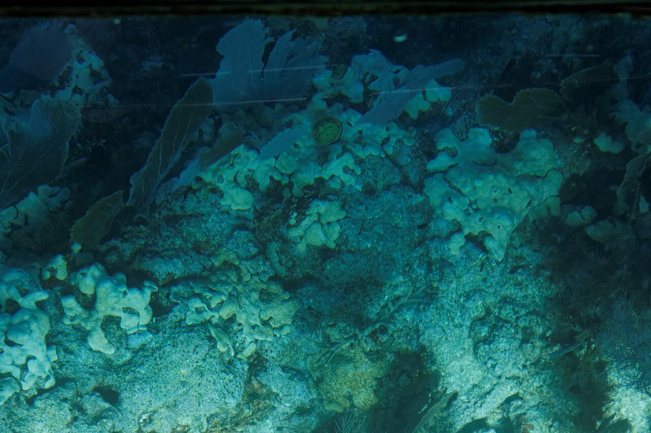
Coral reef and sea life beneath the water at John Pennekamp Coral Reef State Park
Photo: KimonBerlinCC BY-SA 2.0
Verified source

Key Largo · Parks & Beaches

John Pennekamp Coral Reef State Park

John Pennekamp Coral Reef State Park at MM 102.5 in Key Largo was the country's first undersea park, covering 70 nautical square miles of coral reef and mangroves. Glass-bottom boat, snorkel and dive trips leave from the park docks. On land there are two swimming beaches: Cannon Beach, the main snorkeling beach with Spanish shipwreck artifacts offshore, and Far Beach under the palms, plus short trails, a visitor center with saltwater aquariums, a boat ramp and a kayak launch.

102601 Overseas Hwy, Key Largo, FL, 33037

Florida Keys parks & beaches scene
KeysCompass categoryParks & Beaches
Open data

Key Largo · Parks & Beaches

Rowell's Waterfront Park

Monroe County 8-acre passive waterfront park at MM 104.5 on U.S. 1 with picnic tables, benches, a swim-at-your-own-risk shoreline and a kayak- and paddleboard-launching area. Boats and personal watercraft are not allowed.

104550 Overseas Highway, Key Largo, FL, 33037

Florida Keys marinas & boating scene
KeysCompass categoryMarinas & Boating
Open data

Tavernier · Marinas & Boating

Mangrove Marina

Full-service marina on the bayside just north of Tavernier Creek, at 200 Florida Ave near mile marker 91.7 and channel marker 65 on the Intracoastal Waterway. The marina says it has 102 wet slips with power, water and dockside pump-out, dry rack storage, fuel, a travel lift and full onsite marine service, plus its own launch ramp.

200 Florida Ave, Tavernier, FL 33070

Florida Keys public boat ramps & docks scene
KeysCompass categoryPublic Boat Ramps & Docks
Open data

Tavernier · Public Boat Ramps & Docks

Plantation Tropical Preserve Paddle Craft Launch

Dog-friendly

Kayak launch at the Village of Islamorada's Plantation Tropical Preserve, MM 90.8. The preserve is open sunrise to sunset and also has a nature trail, gazebo and picnic tables; there are no public restrooms, and leashed dogs are permitted.

MM 90.8 Overseas Hwy, Islamorada, FL

Florida Keys public boat ramps & docks scene
KeysCompass categoryPublic Boat Ramps & Docks
Open data

Tavernier · Public Boat Ramps & Docks

Tavernier - Jo-Jean Way Boat Ramp

Tavernier - Jo-Jean Way Boat Ramp is a mapped boating-access point in Tavernier, Florida Keys. The mapped name and location come from public map contributors; we do not guess phones, hours or ratings.

Florida Keys parks & beaches scene
KeysCompass categoryParks & Beaches
Open data

Islamorada · Parks & Beaches

Green Turtle Hammock Nature Preserve

Dog-friendly

Village of Islamorada nature preserve at MM 81.2 with nature trails, picnic and play area, pavilion and a fully ADA-accessible floating kayak launch through a short mangrove tunnel to Little Basin. No motorized watercraft are permitted at the launch.

MM 81.2, Islamorada, FL

Florida Keys public boat ramps & docks scene
KeysCompass categoryPublic Boat Ramps & Docks
Open data

Islamorada · Public Boat Ramps & Docks

Islamorada Founders Park and Public Boat Ramp

Village of Islamorada public boat ramp at Plantation Yacht Harbor Marina in Founders Park, mile marker 87 bayside on Florida Bay. The Village lists ramp hours of 8 am to 6 pm daily, a dedicated parking area and trailer parking. Islamorada residents launch free with a valid I.D.; non-residents pay a ramp use fee each way.

87000 Overseas Highway, Mile Marker 87 Bayside, Islamorada, FL 33036

Florida Keys public boat ramps & docks scene
KeysCompass categoryPublic Boat Ramps & Docks
Open data

Marathon · Public Boat Ramps & Docks

33rd St Gulf Boat Ramp (City of Marathon)

City of Marathon public boat ramp at 33rd St Gulf, Mile Marker 49, open 24/7. Launch and retrieval are free for Marathon and Key Colony Beach residents (the City notes exemptions may apply); others pay launch, retrieval and daily trailer-parking fees. No overnight parking.

33rd St Gulf, Mile Marker 49, Marathon, FL 33050

Florida Keys public boat ramps & docks scene
KeysCompass categoryPublic Boat Ramps & Docks
Open data

Marathon · Public Boat Ramps & Docks

Harbor Drive Boat Ramp (City of Marathon)

City of Marathon public boat ramp behind the airport at the corner of Aviation Blvd and Harbor Dr, open 24/7. Launch and retrieval are free for Marathon and Key Colony Beach residents (the City notes exemptions may apply); others pay launch, retrieval and daily trailer-parking fees. No overnight parking.

Aviation Blvd & Harbor Dr, Marathon, FL 33050

Florida Keys public boat ramps & docks scene
KeysCompass categoryPublic Boat Ramps & Docks
Open data

Marathon · Public Boat Ramps & Docks

Ocean View Marina

Dry-storage marina on Overseas Highway in Marathon, developed in 2021 and run by Suntex, on the site formerly known as Harbour Point Marine. The operator lists dry storage, storm and catamaran storage, a haul-and-rack service, a boat ramp and boat rentals.

4681 Overseas Hwy, Marathon, FL 33050

Florida Keys public boat ramps & docks scene
KeysCompass categoryPublic Boat Ramps & Docks
Open data

Marathon · Public Boat Ramps & Docks

The Quay Boat Ramp (City of Marathon)

City of Marathon public boat ramp on the Overseas Highway at Mile Marker 54, near Island Tiki, open 24/7. Launch and retrieval are free for Marathon and Key Colony Beach residents (the City notes exemptions may apply); others pay launch, retrieval and daily trailer-parking fees. No overnight parking.

Overseas Hwy, Mile Marker 54, Marathon, FL 33050

Florida Keys public boat ramps & docks scene
KeysCompass categoryPublic Boat Ramps & Docks
Open data

Bahia Honda · Public Boat Ramps & Docks

Little Duck Key Wayside Park Public Boat Ramp

FWC lists Little Duck Key Wayside Park as a public boat ramp (FWC #25) at US-1 MM 40 bayside on Little Duck Key. Survey notes describe one paved lane, no ramp fee, no docks and no restrooms, with car-and-trailer parking shared with the fishing pier at the west end of the Seven Mile Bridge.

US-1 / Overseas Hwy, MM 40 Bayside, Little Duck Key, FL